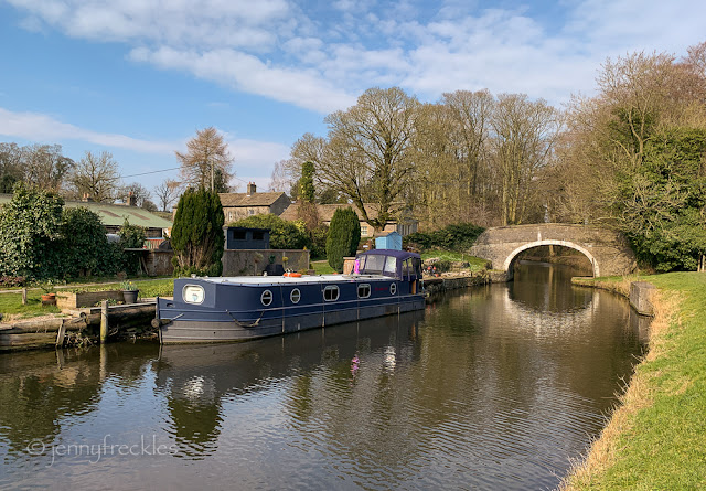
The farthest point on my walk from Gargrave was East Marton, where my route picked up the towpath of the Leeds-Liverpool Canal to take me back to Gargrave. East Marton is a cluster of farm buildings, cottages and a pub, with a newer residential area on the lane down to the church. There is a short stretch beyond Williamson Bridge (above) where narrowboats moor and there is a water point. One of the bridges, below, is double-arched. It was initially a packhorse bridge but was raised when the Skipton-Gisburn turnpike road, now the A59, was built.
The towpath is on the inside of a bend in the canal here, and I noticed this wooden roller, designed to prevent the towropes of horse-drawn boats from rubbing on the wall. Either the roller hasn't always been there or it is not entirely successful, since you can see grooves in the stone worn by ropes rubbing.
Some of the buildings in the hamlet looked pretty old. This cottage had a datestone of 1698 above the door, though you can't always tell if that is original or simply added from an earlier building. It had nice detailing in the wall and round the windows.


Interesting photos...love the old door sill marker. But I admit to being confused and ignorant about "water point" where narrow boats moor. What's a water point? I'll gladly have your reply included to my email below!
ReplyDeleteBarbara, a water point is simply a tap where boats can fill up with fresh water. Some have shower and waste disposal facilities but I think East Marton is just a tap.
DeleteThanks for clarifying that for me!!
DeleteVery much evoking times of old.
ReplyDelete