Thursday, 16 January 2025
Snow melt
Friday, 3 January 2025
Spoke too soon!
Wednesday, 31 January 2024
Blocked
Tuesday, 9 January 2024
York floods
Saturday, 18 November 2023
Turbulence
Sunday, 22 October 2023
Storm Babet
Saturday, 26 November 2022
Fancy a paddle? No!
November has been a wetter than average month and a band of heavy rain moving slowly north-east overnight on 17/18th brought sufficient of a deluge to have an immediate impact on the river levels. It's the first time I've seen the weir in Roberts Park submerged for months. It got to the stage where it was 2/3rds dry over the summer. Looking the other way into Roberts Park, the river has refilled its course and covered over 'the beach' that had emerged.
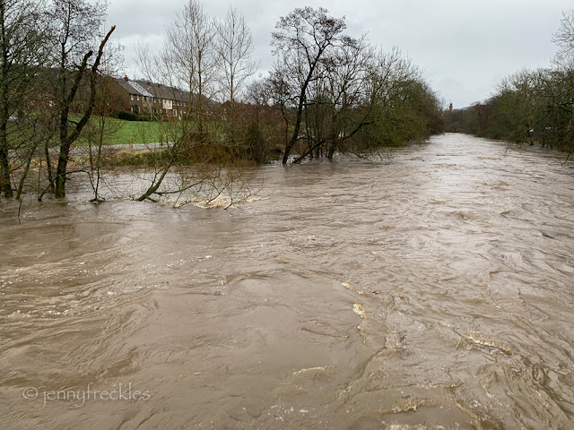
Beyond the park, the river current was strong - easier for the ducks but only as long as they want to travel the way it takes them! I always like this view. You'd never know it was in such a suburban area.
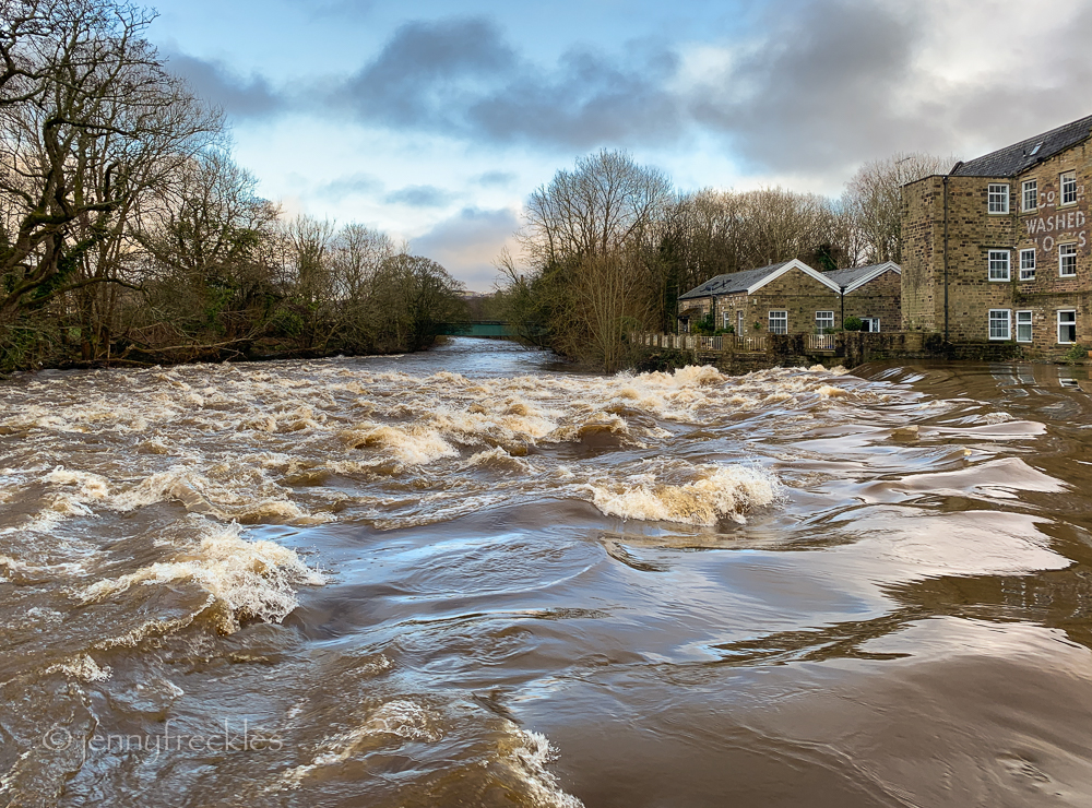
The upper weir at Hirst Wood was fierce. You couldn't see any of the many rocks that litter this area. The original weir has got badly broken down over the years and the stones and rubble have been spread into a wide, rough cascade.
I was intending to enjoy my usual walk along the river and back along the canal but then found my way impeded. There is a stream that runs down from Milner Field, beside the wood. It passes under a rough, low bridge - except that when I got there, it was passing both under and over the bridge! The photo isn't too clear but the water covers all of the foreground and was swirling about rather fast. I considered attempting to walk on the little parapet on the right but, even had I done so, there was a chasm a couple of feet wide at the far side, too big for me to leap and too deep and swirling for me to paddle through (in boots but not wellies). So I had to turn back; better safe than sorry. At least I was at the near end of the river bank path so I didn't have far to walk back. It's rather annoying though, because at some stage earlier in the year someone (not sure who - landowner? river management people?) spent ages digging out the channel of the stream above the little bridge and widening it, presumably to mitigate a perceived problem. End result is that the stream's flow, in mild flood, has been directed further over and obviously now chooses to bypass the bridge. Water will always take the most direct route! I must just remember for the future that if the river level is up to the top step by the rowing club, then I won't be able to negotiate the path further on.
Tuesday, 12 April 2022
York's waterfront
York's riverside is, I find, visually a bit of a mishmash, with very old buildings like the early 17th century King's Arms pub rubbing shoulders with anodyne commercial premises and endless modern apartment buildings.
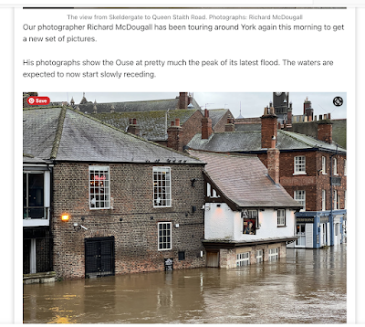
Whenever we get flooding here in Saltaire, you can bet that a few days later the centre of York is inundated, since many of the rivers that arise in the Yorkshire Dales ultimately flow down to swell the River Ouse through York. Some of the buildings alongside the river flood regularly (sometimes up to four times a year!), so much so that they have well-rehearsed drills for dealing with the water, from tall flood barriers that slot in front of their doors and windows to specially tanked rooms with water-resistant plaster to moveable furniture and fittings. When I visited just one month after the latest deluge (see below for a press photo), you would not have known anything had happened, and all was up and running normally again. Remarkable.
Saturday, 12 March 2022
Slow the Flow
Thursday, 24 February 2022
After the storms
Monday, 21 February 2022
Wellies and your big coat needed
It's always a vulnerable spot further upstream by Hirst Weir and the Rowing Club (below), as Lode Pit Beck joins the Aire here. The banking by the weir is quite low and the whole area quickly gets inundated. You can just see the handrail of what is normally the footbridge over the beck. I suppose to an extent it is designed to be like that; allowing flooding on this side relieves the pressure against the old mill on the other bank, which is now residential property.
The footpath through the nature reserve was awash - but this is designated flood plain and the houses above are elevated, hopefully high enough to be safe.
The power of the water was terrifying, but the river level was still well below the footbridge across the Aire, where I stood to take the picture below.
At the time I was exploring, the flooding wasn't as bad as the record floods of 2015, and was similar to those after Storm Ciara in 2020, but the rain was still falling and there was much more water to come down from the higher reaches of the river in the Dales. In the hour I was out, the water level in the park had come much higher, creeping up towards the Half Moon Café.