Earlier posts

Earlier posts
This blog is a continuation of an older one. To explore previous posts please click the photo above.
Showing posts with label Ribblesdale. Show all posts

Friday, 24 February 2023

Wild country


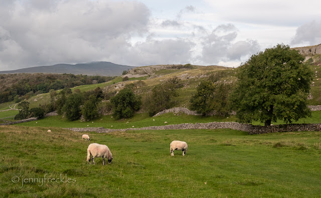
There's a minor road out of Ribblesdale from Stainforth that goes over the fells to the hamlet of Halton Gill in Littondale, which then joins up with Wharfedale. There is very little up there apart from a couple of farms and their stone barns, and quite a few hardy Yorkshire sheep. The scenery, however, is magnificent. The Pennine Way follows the road for a short distance before climbing to the trig point on the western end of Pen y Ghent (the 'whale hump' mountain in my photo below) and then dropping down into Horton in Ribblesdale. It's wild and all very beautiful in a minimalistic way. 

It was so windy up there that I took these photos from the safety of the car, through its open window!


Thursday, 23 February 2023

A donkey track

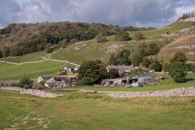
Catrigg Force (see yesterday) sits in a little valley above the Ribblesdale village of Stainforth. To get there you follow a track that my grandmother would have termed 'a donkey track', twisted and tortuous, as though a donkey was let loose on its own! It forms part of the Pennine Bridleway, a National Trail of some 200 miles through the Pennines from Derbyshire to Cumbria. It is the equivalent, I suppose, of the better-known Pennine Way, except that the Bridleway is specifically designed for mountain bikers and horse riders as well as walkers.  The scenery in this stretch is beautiful, even on a blustery day with rain threatening. 


That's Stainforth, in the dip in the fields. It's an attractive little village, and boasts another waterfall on the River Ribble called Stainforth Force, which I've visited in the past (see HERE). 

Wednesday, 22 February 2023

Catrigg Force

Above the village of Stainforth in Ribblesdale, the innocuous little stream called Stainforth Beck runs down from the fells. Suddenly, it disappears... 

It's only the sound of rushing water that gives the game away... A track through a gate leads you down into a wooded ravine and the quite breathtaking sight of Catrigg Force. The stream falls over several big drops (there are more downstream, though you can't easily access those) and through a rather pretty plunge pool.


The advantage of going in winter is that a spectacular cascade of water is more or less guaranteed, and the bare trees enable you to see it well. I could, however, imagine this is a magical place in early summer with young green foliage and, no doubt, wild garlic and other flowers on the banks of the stream. 


With all the beautiful waterfalls we have in Yorkshire, I often wonder why anyone bothers to travel to Iceland! (OK, I know theirs are mostly a lot bigger!) 

Monday, 6 December 2021

Settle station

The railway station in Settle, like most of the stations on the Settle-Carlisle line, retains a lot of its heritage charm. Opened in 1876, as part of the Midland Railway Company, it is still painted in their colours of red (properly called Crimson Lake) and cream. Almost closed in the 1980s, pressure groups ensured its survival and the line has gone from strength to strength, helped by the superb scenery that it passes through, although I believe there are only 8 or 9 services a day through Settle. 

The station occupies an elevated position, giving lovely views across to Giggleswick school's unusual copper-domed chapel  (above) and with a view of Pen-Y-Ghent along the platform (below). 

I was amused to read the signs on the platforms - 'Settle down' on the Carlisle side and 'Settle up' on the Leeds side, though I was puzzled... I always think of anywhere south (Leeds, London) as 'down' and anywhere north (Carlisle, Glasgow) as 'up' so to me these signs were illogical. My knowledgeable friend pointed out that in railway terms, London is the centre, so you always go 'up' to London.


A few vintage suitcases reinforced the heritage feel of the station:

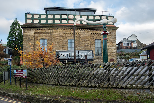
and, in the station yard, what was once a huge water tower with a cast iron tank for replenishing the supplies of steam trains, has been converted into a residential property. I'd love to see inside! The owners are, apparently, fellow Bloggers so there is an entire blog dedicated to it - see HERE - with some photos. 


Sunday, 5 December 2021

Settle

It just happens that I've ventured up to Ribblesdale quite a few times in the recent past. One day I decided to explore the market town of Settle in a little more detail, instead of just passing through. In the photo (below) of its market square, you can just see in the background a rock outcrop with a flagpole atop. That's Castleberg Rock, and I decided to walk up there, just for fun. It's a bit of a steep scramble but worth it for the views, and interesting to watch the rock climbers negotiating the steep crag. 

The panorama from the top is stunning, looking over the town and the neighbouring village of Giggleswick and with far reaching views. The photo (above) taken from that viewpoint, shows the Town Hall, with its numerous chimneys and huge gables, on the left and the famous 'Ye Olde Naked Man Café' just across the main street. According to some accounts, that building dates back to 1663 and was once a house - and the name maybe comes from an undertaker's business or the trade sign of a local carpenter. Other accounts date the building to the 19th century and suggest it may have been an inn. It doesn't really matter. These days it's a family run café and bakery and provided a tasty sandwich and good coffee. I shared an outside table with a couple on holiday and within minutes we'd shared a myriad of details, so that I felt like I'd found a new BFF (as my grandchildren would put it!). She was from Lancashire, he from Yorkshire and I still find it heartwarming how genuine and friendly people can be round here. 

Another notable building in Settle is The Folly, built as a house in the 1670s by a local lawyer, Richard Preston. In its time it has been a farmhouse, bakery, warehouse, furniture shop, bank and even a fish and chop shop. It has been divided up into dwellings and then reunited into one building. A Heritage Lottery Fund grant allowed it to be rescued and preserved. Now it holds the Museum of North Craven Life. 


Just as a foot note, I was intrigued by the carefully chiselled graffiti at the base of the flag pole up on Castleberg Rock - 1841! Proof that 'vandalism' has existed for a long while. 

Saturday, 4 December 2021

Scaleber Foss

Scaleber Foss or Force is a scenic waterfall, just off the road between Settle and Malham. Scrambling down to it through the steep, wooded gorge, on the slippery rocks and fallen leaves, was a little tricky, so I only ventured as far as the first flat viewpoint. Had I been braver (or more foolhardy?) I could no doubt have found a vantage point clear of the trees. Nevertheless you can see it's quite attractive and worth the visit. 

From the road above, the limestone scenery is stunning, with Stockdale Beck carving a route down from the hills on its way to the falls. 

Saturday, 27 November 2021

Autumn riches

Autumn came slowly this year, with a whispering softness that at first made me impatient and then eventually beguiled me. The woodland below the old limestone quarry between Langcliffe and Stainforth was full of subtle colour. 

By contrast, trees in the nearby market town of Settle were bolder: copper, gold, russet and orange glowing beautifully in the sunshine.


Friday, 22 October 2021

River Ribble


It took us a few minutes to locate the right path after lunch in Feizor. Being relaxed and full of good food clearly dulled our wits a little! Eventually we found the route, which follows the Dales High Way long distance path over to the River Ribble at Stainforth. Lovely views again from the top and then a gentle stroll downhill into the valley, punctuated by some rather high ladder stiles and precarious stone step stiles. Those have cantilevered stones right through the wall, and are often slippery and uneven with use. As it says in an article I read: 'All is typically well until you reach the top, when realisation dawns that you will have to pirouette to face the other way before descending the other side, as the stones are the same on both sides.'  Pirouetting feels harder when you're full of Sunday lunch, I have to confess, not to mention the complications of heavy boots, bulky backpacks, a walking pole and my camera!  

Anyway, we successfully arrived at the river in Stainforth, beside the rather elegant old bridge, built around 1675 to span the river instead of the original ford. (Stainforth means 'stony ford'.) People call it a packhorse bridge but it is in fact wide enough for carts, and many true packhorse bridges don't have such high parapets, in order to allow the heavily laden horses to pass across unimpeded.

Below the bridge, the river tumbles over falls known as Stainforth Force. There was quite a crowd of people here and when we neared the falls we realised why. In the autumn, salmon migrate up river to spawn and they leap up the falls in spectacular fashion. We were lucky enough to see several fish attempting the jump, though I found it impossible to photograph them, what with all the spectators and the fact that the fish are very fast and you can't predict where they will appear.  I was frankly astonished to see them, having spent some time here in past autumns and never seeing one. Quite a thrill! 


Downstream of the falls the river becomes calmer, meandering along through meadows. There isn't much autumn colour in the leaves yet, but there are a lot of red hawthorn and rowan berries. 


And so back into Settle, past a couple of old mills that were originally fulling mills and then cotton mills, and nowadays are converted into apartments and small business units. 

Thursday, 21 October 2021

Improbable walls


The Yorkshire Dales are famed for the drystone walls that snake across the countryside. Ribblesdale is no exception and here the local limestone gives characteristically lumpy and quite light-coloured walls. I always marvel at the improbable constructions - tumbling down over crags or meandering round as if built by a drunkard. I often find myself asking... why on earth was that built there? Why is it that shape? Who built it in the first place? How old is it? Those questions never get answered but that doesn't stop me wondering. 


Wednesday, 20 October 2021

Settle Circular


My friend and I were fortunate to have a glorious early autumn day for an eight mile circular walk from Settle, a market town in Craven on the western edge of the Yorkshire Dales. The route took us from the River Ribble, up along Giggleswick Scar and over to the hamlet of Feizor. This is limestone country, with remnants of limestone pavement and the characteristic drystone walls everywhere. There are wonderful views up Ribblesdale. You could see Pen-y-ghent, the lowest of Yorkshire's Three Peaks, in the distance. I rather liked the way the tumbledown wall in the foreground echoed the shape of the mountain.  
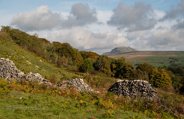
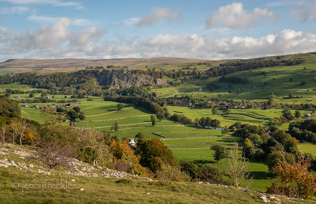
Looking down along the valley, the village of Langcliffe sits downstream of Stainforth Scar. During the late 19th and early 20th centuries, limestone was quarried in this area by Craven Lime Works and burned in a massive Hoffman kiln to produce lime that was used in agriculture and building (mortar and limewash) as well as in a host of small-scale industries: tanning, textiles, soap and paper making. I once visited the remains of the Hoffman kiln, which was very interesting. (See HERE


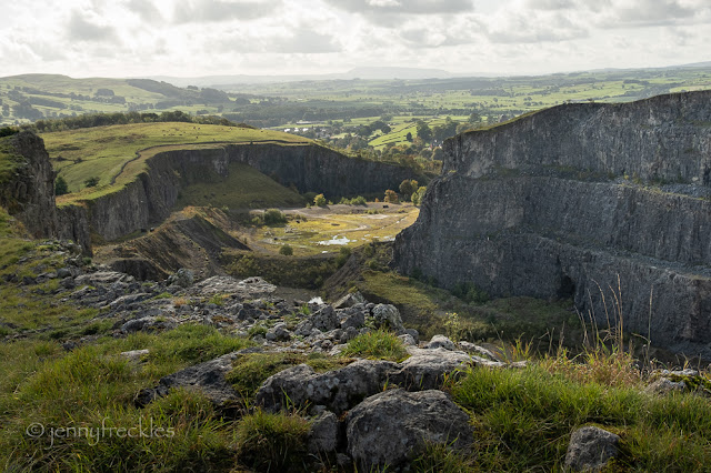
On the other side of Giggleswick Scar, part of the Scar has been extensively quarried for building materials. The huge quarry was closed ten years ago and the land is now earmarked for some kind of industrial development. On the far horizon you may just be able to see the distinctive whaleback shape of another peak, which is Pendle Hill in Lancashire. 


Further on, the path meandered through upland meadows, which in summer are rich with wildflowers.


We then dropped down to the hamlet of Feizor, where there is a very popular café: Elaine's Tea Rooms, a real hidden gem, with plenty of outdoor seating. (I think it's still advisable to sit outside in these Covid times, even though it's getting colder.)  It's not often I have a full Sunday lunch halfway through a long walk. It was delicious - though it maybe made for a slower walk onwards, since I was rather full and thus quite sleepy! 

Monday, 23 August 2021

Thorns Gill packhorse bridge


To get to the deserted hamlet of Thorns (see earlier posts) from the (modern) road you have to pass over a packhorse bridge at Thorns Gill that straddles Gayle Beck, one of the streams that sources the River Ribble. The bridge is believed to be at least 300 years old, a high arch made of rough limestone that appears to grow out of the rock on either side. The limestone river bed below is scoured and pitted with deeply eroded pools. There was little water in it when I was there. In limestone country the streams often disappear to flow underground in dry weather. The chasms show that sometimes the water must churn through the narrow ravine in a torrent. 

The bridge from above is little more than six feet wide, with no parapet (so that the heavily-laden packhorses could pass over without hindrance). Imagine the jaggermen - the drovers, with a chain of perhaps twenty or thirty packhorses - traversing the bridge on a pitch black night in the depths of winter, having walked from Settle, perhaps, on the way to the market at Gearstones or even further to Hawes or Askrigg. The whole of this northern countryside was crisscrossed with similar trails, since goods were almost exclusively transported by packhorse from farm to market. 

Sunday, 22 August 2021

These things connect us


This substantial bank barn is the most complete structure remaining in the deserted hamlet of Thorns, Ribblehead. (A 'bank barn' is built into a hill or slope so that the lower and upper levels can both be accessed from the ground, usually with livestock kept below and a threshing floor on the upper level.)


There are little indicators of its past life - a wisp of rope, a rusty hinge, a galvanised metal bin, the careful arrangement of stones and sills, placed hundreds of years ago by a human hand. These things connect us to the past and bear witness to the resilience of the folk who eked out a living in these remote fells, farming, raising children, doing the laundry and keeping a fire burning in the hearth. 


Away in the distance, you can just catch a glimpse of the huge Ribblehead railway viaduct, built over several years in the 1870s. The hamlet of Thorns was still occupied at that time. I wonder how the inhabitants reacted to the sight of hundreds of navvies engaged in its construction. Did they wonder at it, gawp at the shanty towns that sprang up to house the workers? Or did they feel aggrieved that their remote and yet familiar existence, hardly changed for hundreds of years, was being invaded by the 'modern' world's noise and hustle? Who knows? - but what we do know is that Thorns itself was abandoned by 1890, its purpose all but extinguished. 


Saturday, 21 August 2021

The deserted hamlet of Thorns

Our destination for the camera club outing at Ribblehead was the long deserted hamlet of Thorns. Situated on an ancient packhorse route, at one time drovers passed through, taking livestock and goods to market. Census and other documents tell us that in 1538 there were five inhabited properties here. By 1841 there were three households and the hamlet was uninhabited by 1891. Presumably passing traffic ceased and more reliable employment was to be found in the towns as the Industrial Revolution changed society. 

What remains - stone walls, the foundations of houses and barns, is evocative of another time. You can imagine washing hanging on a line, children clambering over the boulders left in the fields by glaciers, the clatter of the drovers passing through. It must have been a scratched existence at the best of times. 

There is evidence of a small ford (below) and some of the barns have been more recently used by farmers, though they are all now derelict. 


All around, the grandeur of the scenery (Ingleborough, below), calling birds, bleating sheep, ever-changing weather. Bleak and yet beautiful.